NOAA Tides and Currents Data
The NOAA
Tides and Currents
site provides access to historic and real-time water level data.
RAMADDA provides 4 entry types for accessing this data-
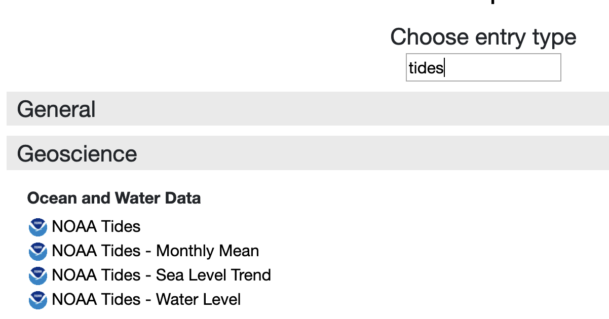
Each of these entry types takes a Station ID (e.g., 8575512). Upon entry creation RAMADDA
will fetch the metadata for the site from NOAA and populate the entry with the station name,
latitude/longitude, flood stages and sea level datums.
The Station IDs per state can be viewed at the
NOAA site.
You can specify a single Station ID or you can upload a file that contains any number of
Station IDS through the Bulk Upload form entry. As a convenience the list of sites per state are
available on
Github.
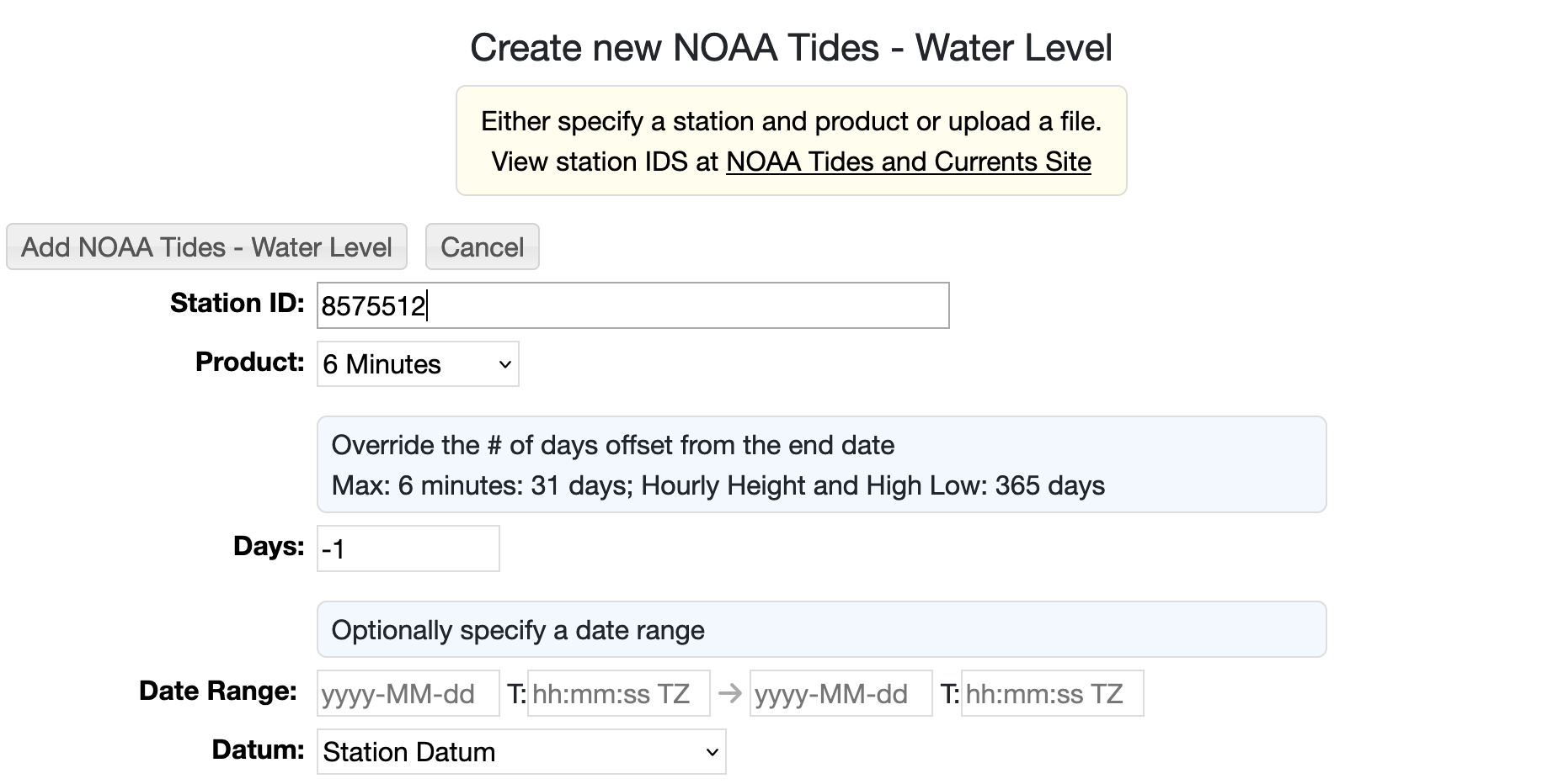
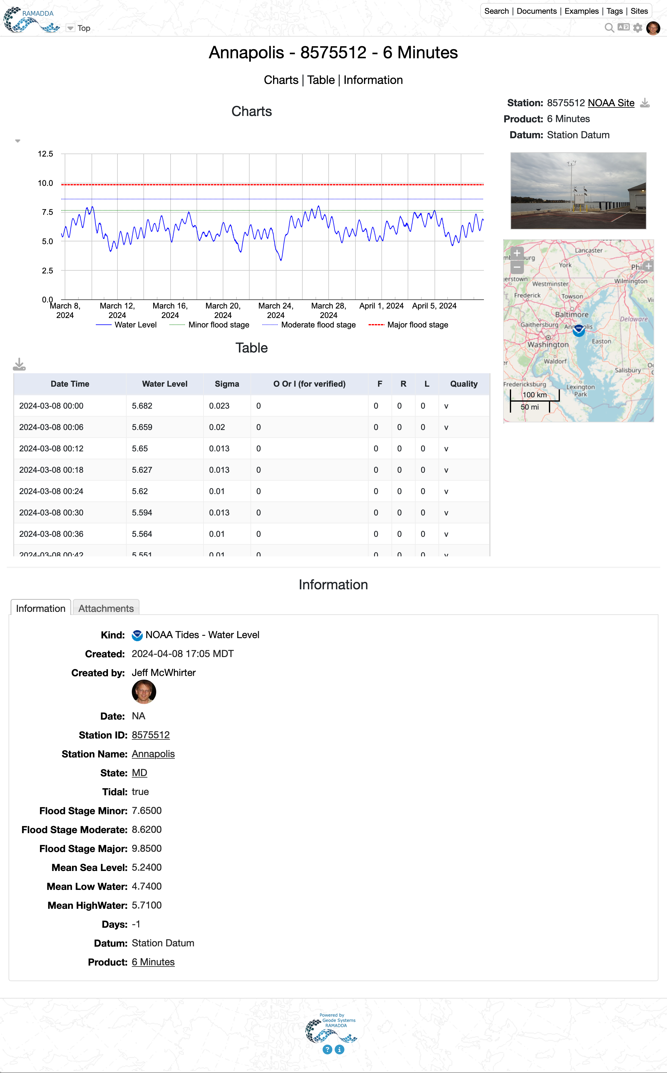
The NOAA Tides - Water Level entry type can read one of 3 products - 6 Minutes, Hourly Height, High/Low. e.g., see the
example site @NOAA. You can also specify the datum for the water levels.
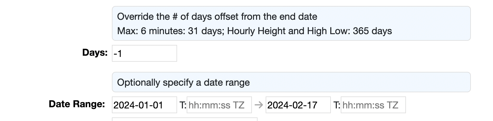
Each of these products can have a maximum number of days. If the number of days < 0 then RAMADDA uses the maximum
number of days offset from the current time:
One can also specify a number of days offset from either the current time:
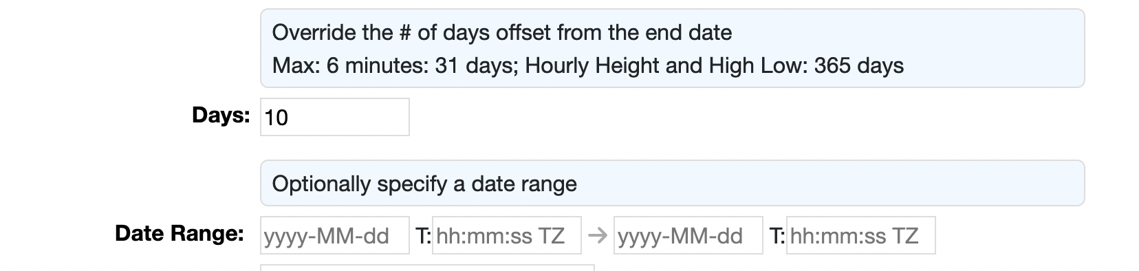
Or specify a number of days offset from the end date of the entry
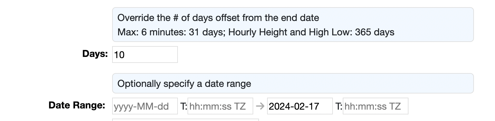
Or specify an absolute date range with the start and end dates of the entry:
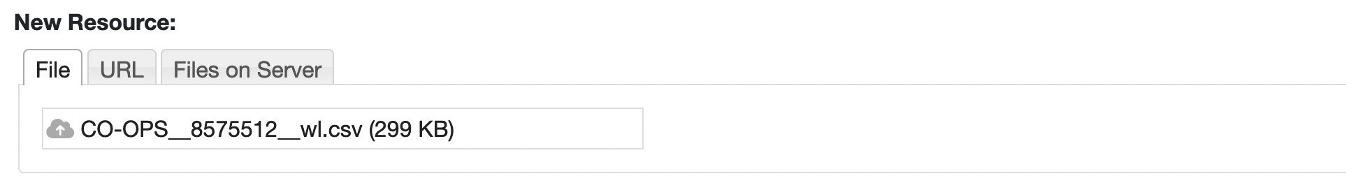
You can also download one of the files from the NOAA site (or from the RAMADDA entry) and upload the file
to the Water Level entry:
The default display of the Water Level entry includes a display of the minor/moderate/major flood levels.
Note: the flood levels are based on the Station Datum water level height.
The Monthly Mean entry type operates similarly to the Water Level for specifying a date range.
However, this data can span decades. The default is to read 40 years of data.
The NOAA site provides long term sea level trend data, e.g.
https://tidesandcurrents.noaa.gov/sltrends/sltrends_station.shtml?id=8575512
. The Sea Level Trend entry type requires a Station ID. It will download the file and store it
in RAMADDA.
The NOAA Tides entry type is just generic and takes any of NOAA CSV data files.
RAMADDA provides a gettide.sh shell script that will download all of the hourly heights
for a given station and process it to give the count of hours above flood stage per year and
a listing of flood events. The heights data can be extensive, dating back close to a century for some
stations.
The script is available on github @
https://github.com/geodesystems/ramadda/blob/master/src/org/ramadda/geodata/point/bin/gettide.sh
.
The script requires the RAMADDA
SeeSV package
to be installed. Consult the documentation in the script.