| Both the Multi-Entry Glyph
and the Group Glyph can be configured so that all of their
children glyphs are displayed with the same data icon.
|
To follow download the example at
https://ramadda.org/repository/a/userguide_dataicons
and import it into your RAMADDA.
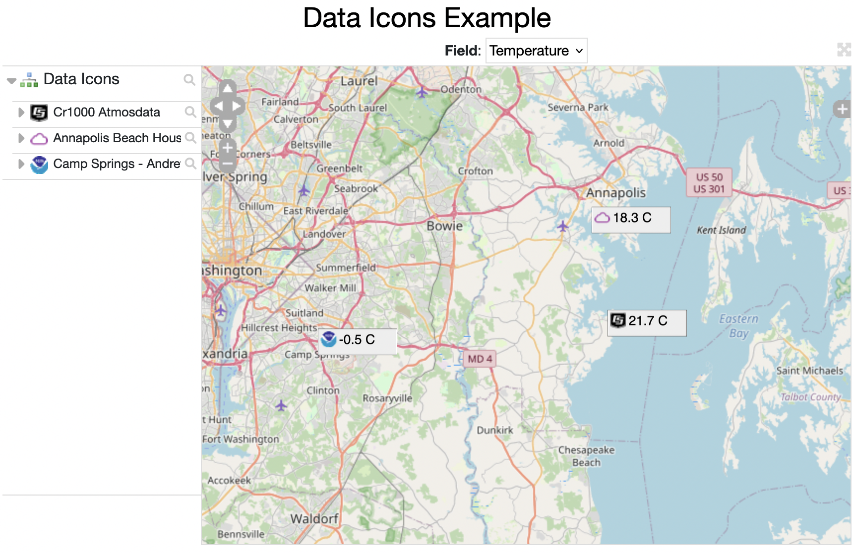
The example is composed of a Group that contains three different entries -
a CR1000 data logger file, a Purple Air sensor and a real-time NWS weather
data file.
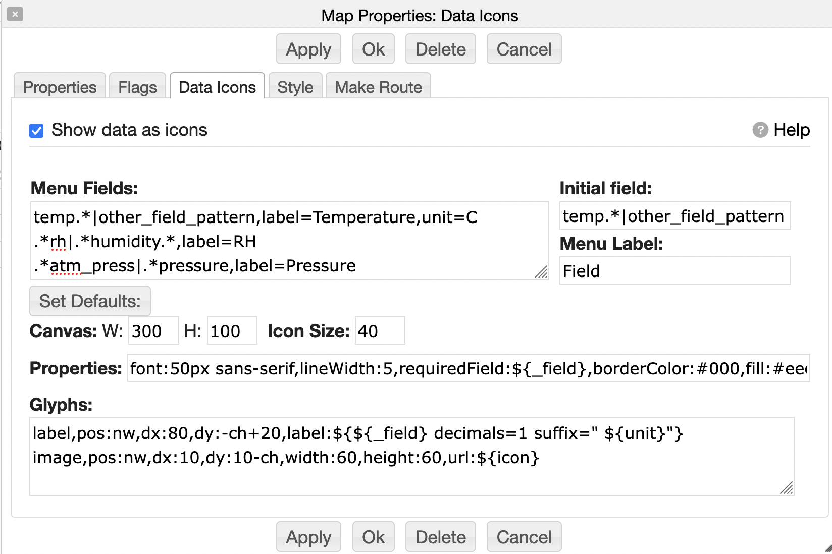
Under the Data Icons section of the Properties dialog for the group are specifications
for both the pull-down field menu as well as overwriting how the
data icons are displayed.
There are 7 lines in the Menu Fields.
The data files share some similar fields (e.g., temperature) but
the field names vary (e.g., "rh" and "humidity") and only the Purple Air
entry has the pm1.0, pm2.5 and pm10.0 fields.
The "|" separated field ids, e.g.
.*rh|.*humidity, allow one to match
on any of the patterns.
temp.*|other_field_pattern,label=Temperature,unit=C
.*rh|.*humidity.*,label=RH
.*atm_press|.*pressure,label=Pressure
windspeed,label=Wind Speed
pm1.0
pm2.5
pm10.0
Under the Set Defaults button are a set of inputs for specifying how the data is displayed.
If there isn't anything set in the fields (e.g., Canvas, Properties, Glyphs) then the Set Defaults
button will set them with initial default values.
You can think of the Glyphs as a set of drawing commands that draw into the canvas.
The canvas has a specified width and height. That canvas is then converted into an image
and that image is displayed as an icon in the map with the specified Icon Size.
There is in depth documentation available
here.
The Properties have both default attributes for the Glyphs as well
as background for the canvas as a whole.
#What font to use for the label Glyph
font:50px sans-serif

#If the data does not have the specified field then the icon is not shown
#the ${_field} is a macro that is replaced with the selected field
#from the Field Menu
requiredField:${_field}

#This specifies the background and line color for the rectangle
borderColor:#000
fill:#eee
lineWidth:5
The Glyphs are the drawing commands, one per line.
#Draw a label with the given template
#The ${_field} is a macro that is replaced with the selected field
label,pos:nw,dx:80,dy:-ch+20,label:${${_field} decimals=1 suffix=" ${unit}"}

#Draw an image with the icon for the Map Glyph
image,pos:nw,dx:10,dy:10-ch,width:60,height:60,url:${icon}